The winter storm this week has brought snow to Mission Peak (Riisima), where there usually isn't any. I managed to take a hike up there to see it.
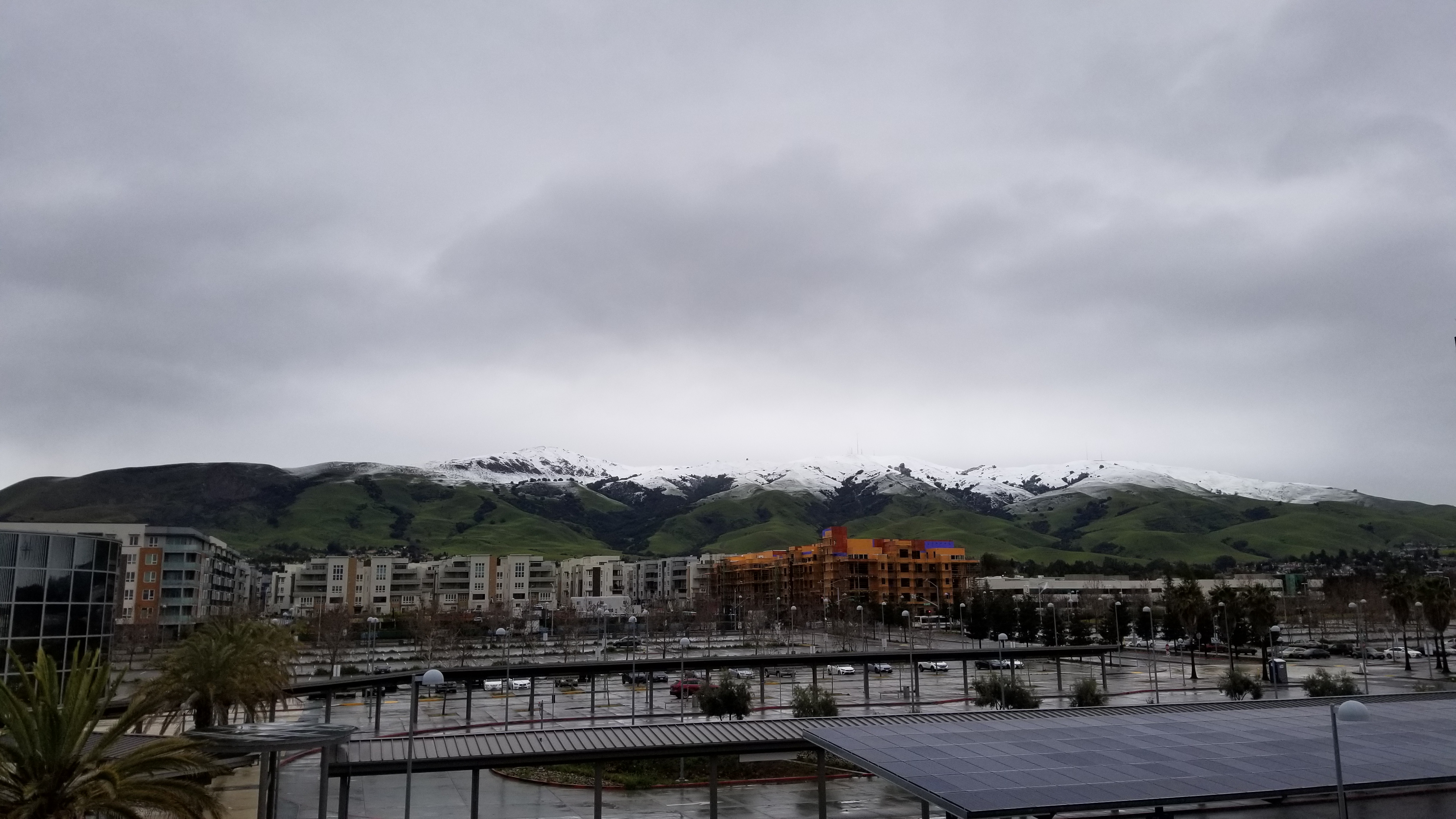
The highest amount of snow we got was on Friday the 24th. There were also a lot of low clouds that day. The view from the Warm Springs BART Station is pretty great, though to get the best view of the peak you need to be careful to head upstairs from the south end of the platform. If you exit the paid area, you'll be stuck in the center, with a lot of architecture in the way.
By Saturday, there was less snow, but clearer skies.
I headed uphill from the Stanford Avenue staging area. The main way up from there was about as busy as I'd expect under the circumstances. A lot of the path was covered in a layer of very thick, clay-like mud. As we got to the altitude where there was actually snow on the ground, the mud started to get slushy in places.
Near the peak, the trail is the same path that water from rain or melting snow wants to take. A lot of the trail near the top was accompanied by a little river that ran down the center of the path, or cut back and forth across it.
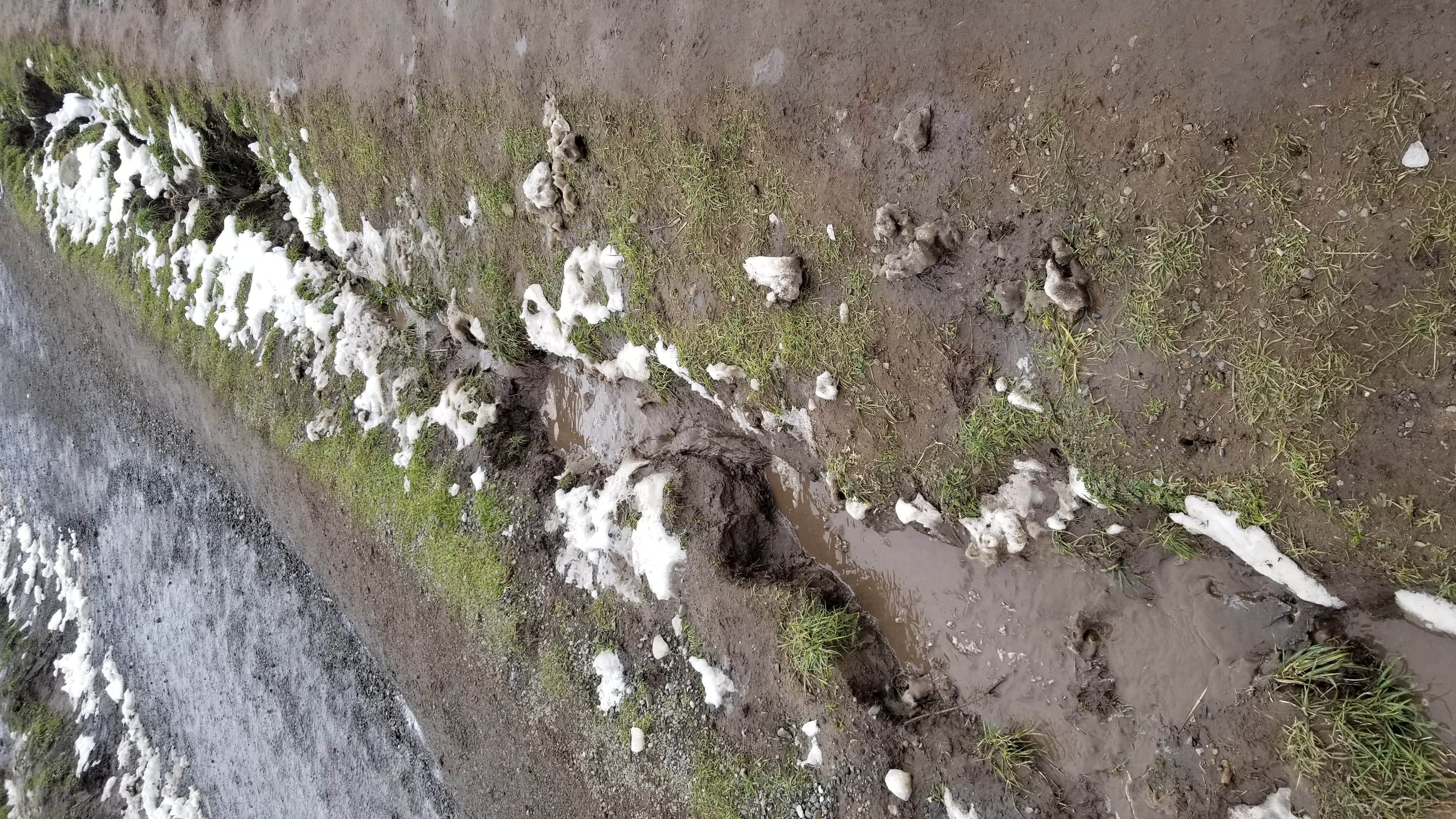
The trickiest part was just before the top, where the mud and snow got very slushy and slippery, with varying amounts of seashell-fossil-filled rocks mixed in. Right at the top of the mountain, everything dried out again; there was no more water from above dripping down on it.
Here's a view looking out over the Bay.
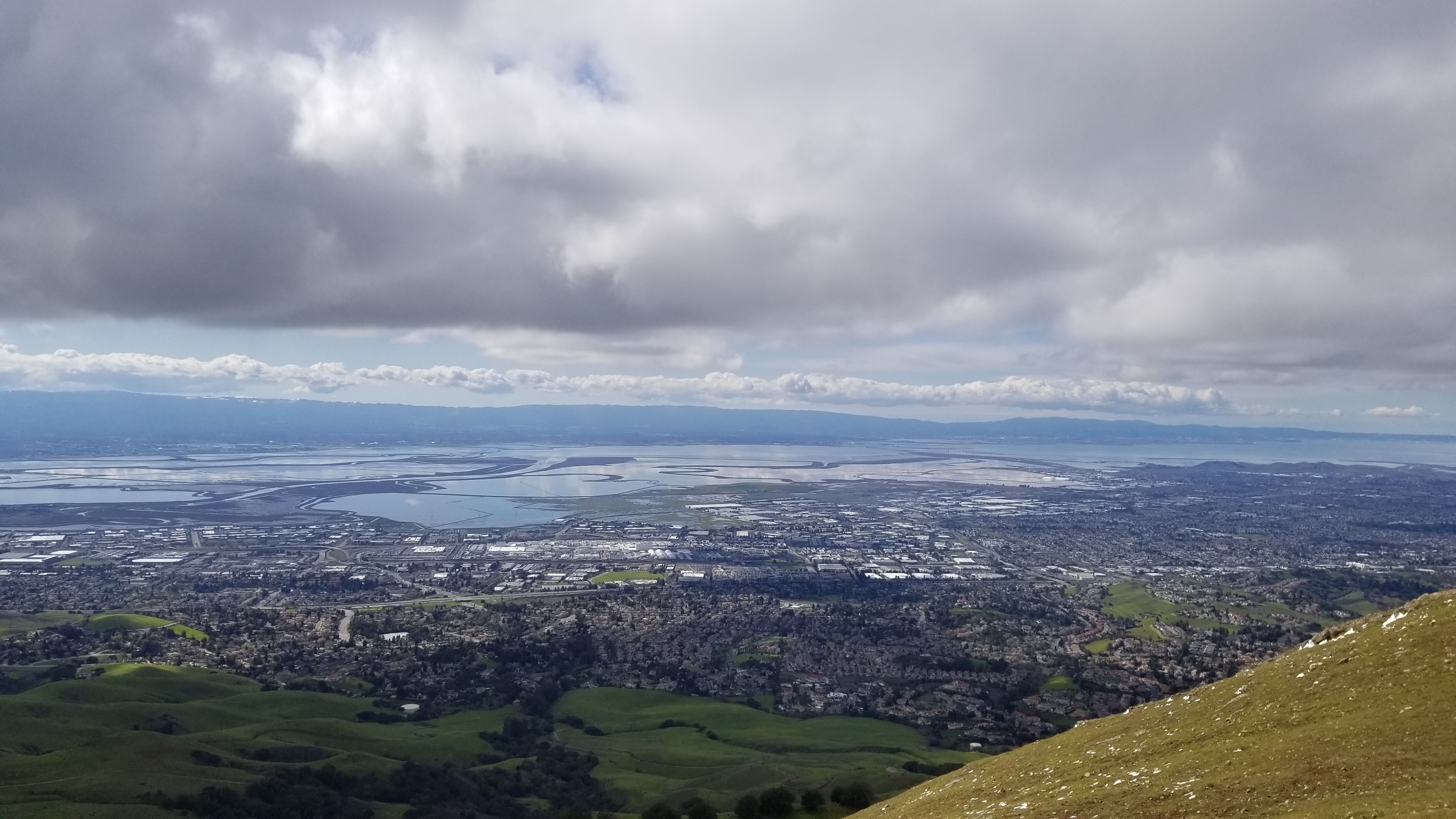
There are more hills to the east.

The highest concentration of nearby snow was around the antennas on Mount Allison.
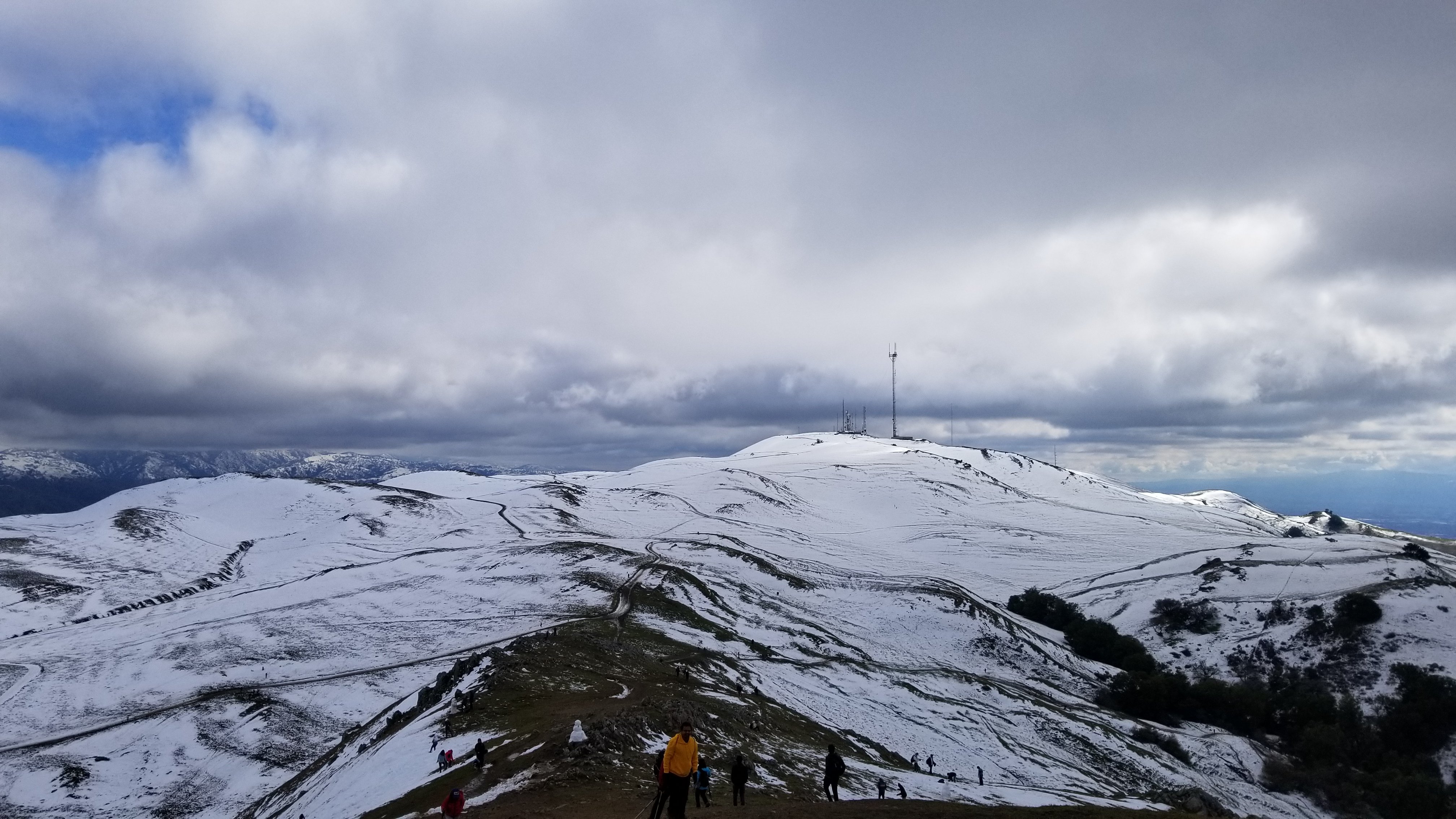
There weren't as many people stomping around in snow off-trail as I might have feared, but there were a few snowmen.
At this point, I was rather keen to avoid the steep slushy climb on the way back. On top of my own discomfort navigating that in a crowd, there was also someone asking around at the peak if there were any doctors or nurses present; someone had gotten injured on that section. So I decided to try going back via the other road leading off the peak, which starts out going southeast toward the antennas and loops around clockwise.
This way seems less steep, mostly, and far less rocky, but it makes up for that by having many more muddy sections. The mud actually approaches California Caverns levels of boots-grabbing, in places. The upside is that there are a lot fewer people, and more opportunities to go through clumps of trees. Now and then a well-established stream runs over or under the trail.
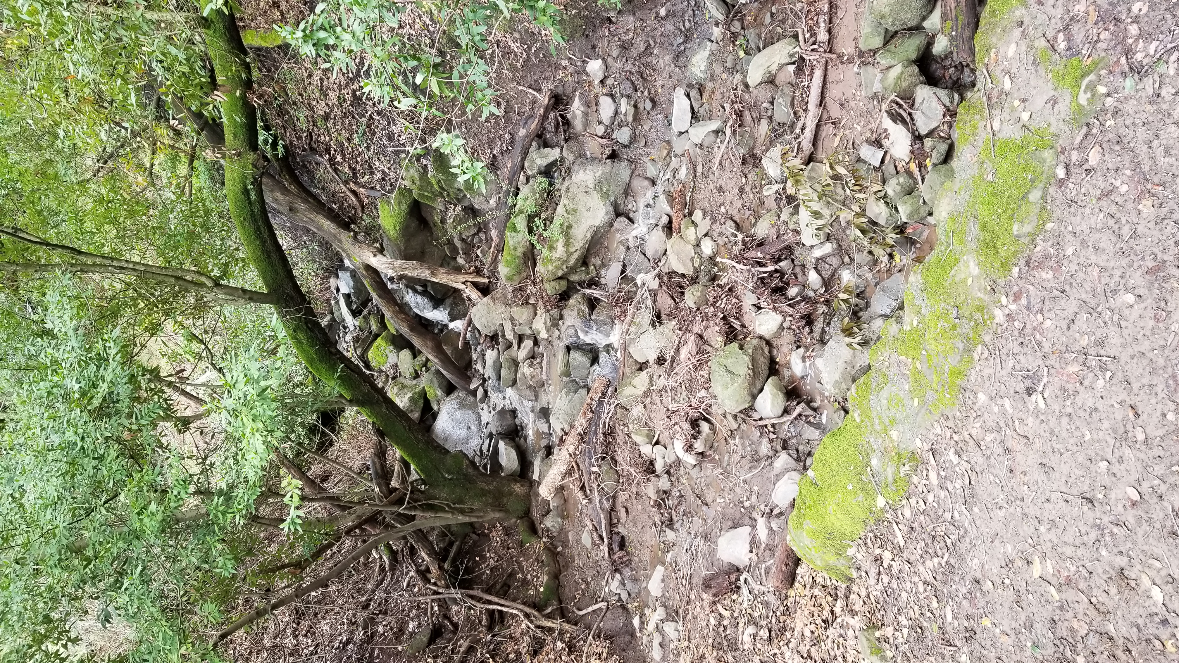
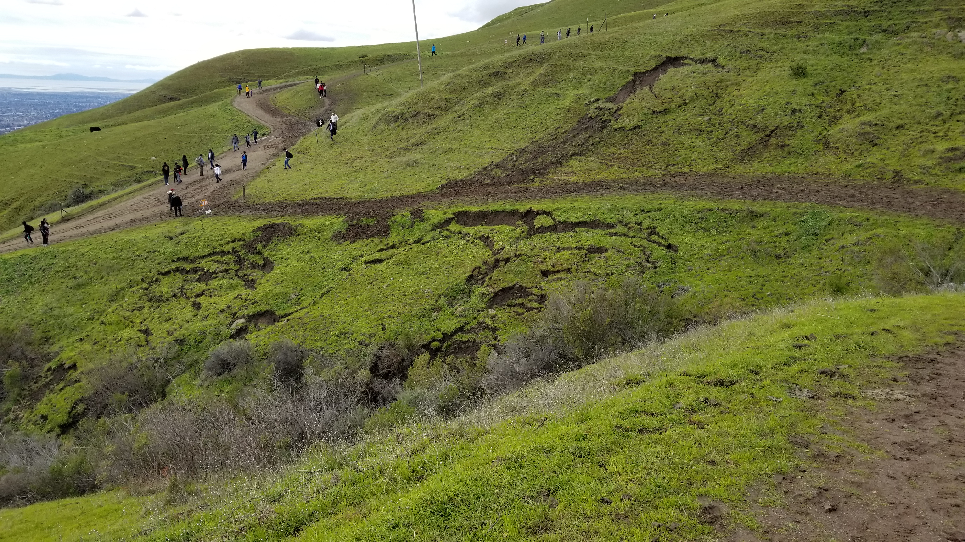
This stream had taken out about half the trail, though there was plenty of space to cross it in the remaining width. In a few places there was evidence of nearby landslides. It wasn't until I got back to the main trail that I saw there was a sign warning of storm damage on the Peak Meadow Trail; there wasn't a sign on the far end, and I hadn't noticed it on the way up because I hadn't considered taking that path until later.
When I finally got back to the staging area, an ambulance and fire truck were pulling in. I never found out if they were there for the person I'd heard of earlier, or if more than one person needed them that day.
There was more rain on Sunday, and by Monday morning there was only a little snow left visible from the BART station. Just as well; next time I go, I'd rather go when it's not so muddy. At some point I should try starting from Ohlone College. That starting point is already partway up the hill, with better bus access.